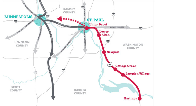
This work is being updated as part of the Implementation Plan in order to assess the market driven potential for development based on bus rapid transit.
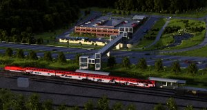
The proposed St. Paul Lower Afton station would be located at Lower Afton Road and Highway 61. Long-term plans for the transit station include a 275-stall parking facility tucked into the sloping hillside at the northeast corner of the intersection. A pedestrian bridge spanning U.S. Highway 61 would provide easy pedestrian access to the transit platform. The plans also call for restoring green space and adding bio-filtration swales and naturalized plantings. New sidewalks and trails will be added that will connect to local and regional trails as well as Battle Creek Park.
The final station area plans, completed in 2011, recommend that no new significant residential or business development should occur near the station to respect the natural setting of the river valley. However, decisions regarding residential and business development near McKnight Avenue will be coordinated by city staff and local elected officials. 
- Birds-Eye View of Lower Afton Station Looking Northeast
- View of Lower Afton Drop-off
- Lower Afton 2040 Concept Plan
- Perspective Views of Lower Afton Station
- Aerial View of Lower Afton Station Trails and Greenspace
- Lower Afton Station Cost Analysis
Leave a comment for the Red Rock Corridor regarding the station planning for the Lower Afton site in St. Paul. Comment


